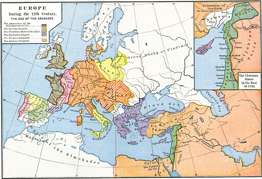
Description: A map of Europe, Western Asia, and Northern Africa during the 12th Century and the Age of the Crusades. The map is color–coded to show the possessions of the Plantagenets, the German Empire, the Christian States in the East, the Byzantine Empire, the Western Caliphate, and the Eastern Caliphate. An inset map details the Christian States in the East.
Place Names: Regional Miscellaneous, Armenia, �Bulgaria, �Denmark, �Egypt, �England, �France, �Germany, �Hungary, �Ireland, �Norway, �Poland, �Portugal, �Prussia, �Sardinia, �Scotland, �Serbia, �Sicily, �Spain, �Swede
ISO Topic Categories: borders, �historical, kWorldMedSea, kWorldEurasia, kWorldAfroAsia
Keywords: Europe During the 12th Century - The Age of the Crusades, borders, �historical, historical event, borders, �historical, kWorldMedSea, kWorldEurasia, kWorldAfroAsia, Unknown, 1096–1192
Source: Robert H. Labberton, New Historical Atlas and General History (New York, NY: Townsend MacCoun, 1886) Plate XXXIII
Map Credit: Courtesy the private collection of Roy Winkelman |
|