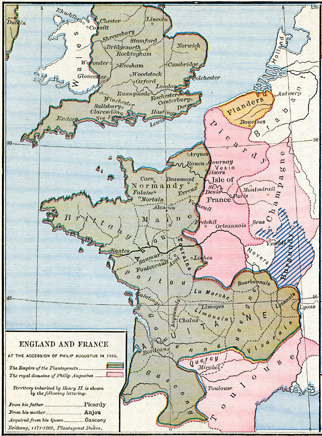
Description: A map of England and France at the accession of Philip Augustus in 1180. The map is color–coded to show the Empire of the Plantagenets and Philip Augustus, and indicates territory inherited by Henry II from his mother and father, and acquired from his Queen. The map notes Brittany under control of the Plantagenet Dukes between 1171–1202.
Place Names: Western Europe, Anjou, �Aquitane, �Brittany, �Burgundy, �Flanders, �France, �Gascony, �Maine, �Normandy, �Orleannois, �Oxford, �Picardy, �Toulouse, �United Kingdom, �Wales,
ISO Topic Categories: oceans,
location,
inlandWaters,
boundaries
Keywords: England and France at the accession of Philip Augustus, borders, �historical, historical event, oceans,
location,
inlandWaters,
boundaries, Unknown, 1180
Source: Robert H. Labberton, New Historical Atlas and General History (New York, NY: Townsend MacCoun, 1886) Plate XXXIV
Map Credit: Courtesy the private collection of Roy Winkelman |
|