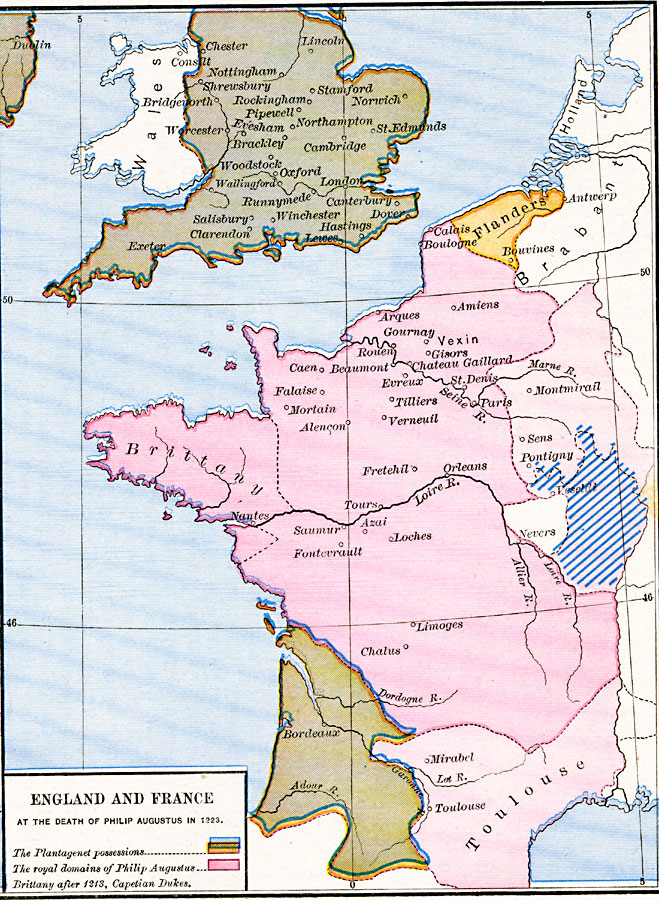
Description: A map of England and France at the death of Philip Augustus in 1223. Philip Augustus was a member of the House of Capet, and was responsible for breaking up France's Angevin Empire of the House of Plantagenet. This map is color–coded to show the remaining Plantagenet possessions and the royal domains of Philip Augustus. This map also shows important cities of the time, and the country of Flanders with the battle site of Bouvines, and the Duchy of Burgundy.
Place Names: Western Europe, Brittany, �Flanders, �France, �Oxford, �Toulouse, �United Kingdom, �Wales, Bouvines
ISO Topic Categories: oceans,
location,
inlandWaters,
boundaries
Keywords: England and France at the death of Philip Augustus, borders, �historical, historical event, oceans,
location,
inlandWaters,
boundaries, Unknown, 1223
Source: Robert H. Labberton, New Historical Atlas and General History (New York, NY: Townsend MacCoun, 1886) Plate XXXIV
Map Credit: Courtesy the private collection of Roy Winkelman |
|