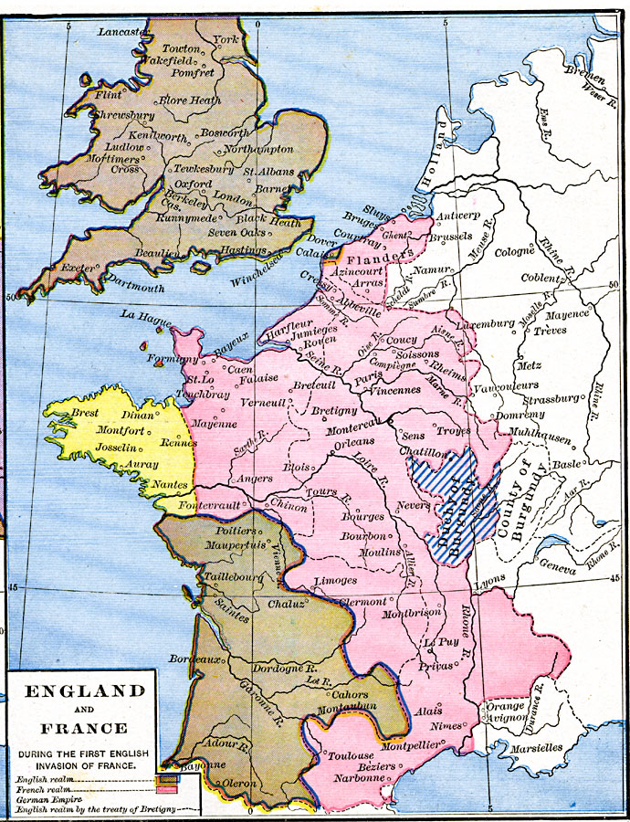
Description: A map of England and France during the first English invasion of France from Edward III in 1337 to the Treaty of Brétigny in 1360. The map is color–coded to distinguish English land from French land, and the boundary of the British realm established by the Treaty of Brétigny, including the renounced claims to Brittany. The map also shows the western extent of the German Empire and the Duchy of Burgundy. Important cities of the time and major rivers are shown.
Place Names: Western Europe, Burgundy, �England, �France, �Holland, �United Kingdo
ISO Topic Categories: oceans,
location,
inlandWaters,
boundaries
Keywords: England and France during the first English invasion of France, borders, �historical, other military, oceans,
location,
inlandWaters,
boundaries, Unknown, 1337–1360
Source: Robert H. Labberton, New Historical Atlas and General History (New York, NY: Townsend MacCoun, 1886) Plate XXXV
Map Credit: Courtesy the private collection of Roy Winkelman |
|