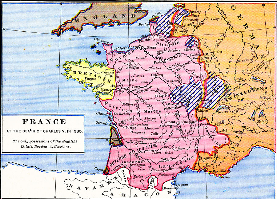
Description: A map of France at the time of the death of Charles V in 1380. This map is color–coded to show the territory of France at the time, the possessions of the House of Burgundy (Artois, Flanders, Rethel, Duchy of Burgundy, and Franche–Comte), the neutral region of Bretagne (Brittany), the English possessions of Calais, Bordeaux, Bayonne, and the Guernsey Islands, and the western border of the Holy Roman Empire.
Place Names: France, Aquitaine, �Dauphine, �Languedoc, �Normandy, �Picardy, �Poitier
ISO Topic Categories: oceans,
location,
inlandWaters,
boundaries
Keywords: France at the Death of Charles V, borders, �historical, other military, oceans,
location,
inlandWaters,
boundaries, Unknown, 1380
Source: Robert H. Labberton, New Historical Atlas and General History (New York, NY: Townsend MacCoun, 1886) Plate XXXVI
Map Credit: Courtesy the private collection of Roy Winkelman |
|