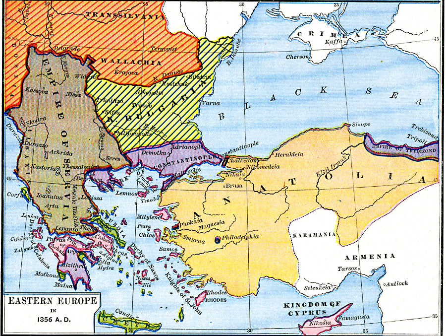
Description: This map of Southeastern Europe shows the empires and territories in the Balkans and Anatolia at the time of Stefan Dushan's (Tsar of the Serbs and Greeks) death in A.D. 1356. This map shows Bohemia, Transsilvania (Transylvania), and Wallachia under control of the Kingdom of Hungary, the Empire of Servia, the Kingdom of Bulgaria, the Venetian possessions in Greece and Crete, the states in Greece and the Kingdom of Cyprus under Latin rule, the Byzantine Empire of Constantinople, the Greek Empire of Trebizond, and Anatolia under the Ottoman Turks (Osmanli). The map shows major rivers and important cities of the time.
Place Names: Southeastern Europe, Albania, �Anatolia, �Bulgaria, �Constantinople, �Crete, �Cyprus, �Serbia, �Transylvani
ISO Topic Categories: oceans,
location,
inlandWaters,
boundaries
Keywords: Eastern Europe, borders, oceans,
location,
inlandWaters,
boundaries, Unknown, A.D. 1356
Source: Robert H. Labberton, New Historical Atlas and General History (New York, NY: Townsend MacCoun, 1886) Plate XXXVI
Map Credit: Courtesy the private collection of Roy Winkelman |
|