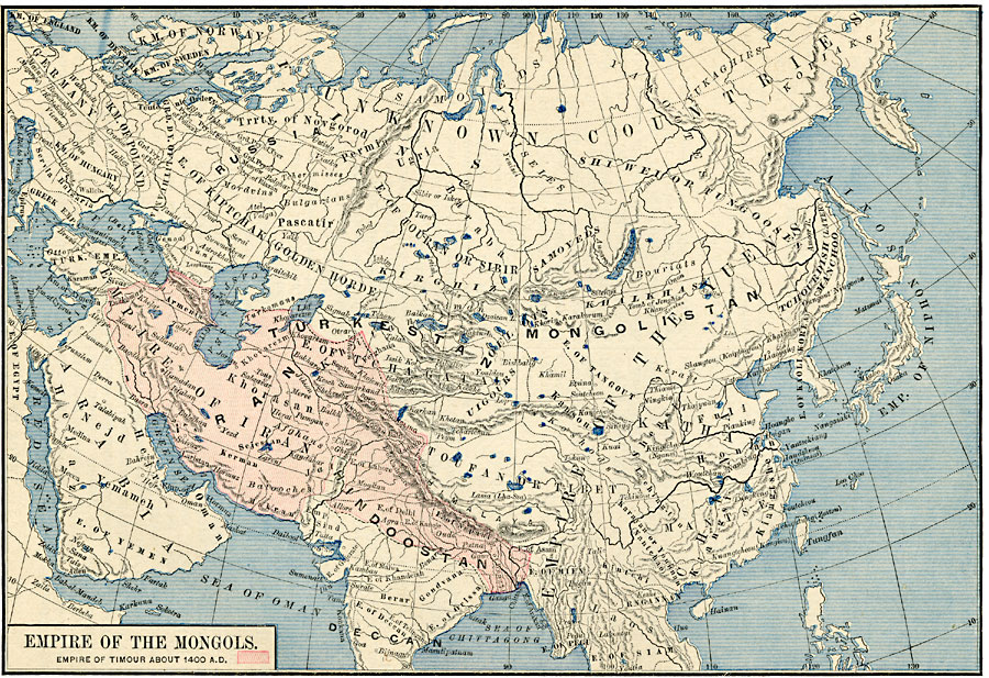
Description: A map of Asia showing the Empire of the Mongols in the thirteenth and fourteenth centuries at the time of the second Mongol invasion. The map is color-coded to show the extent of Empire of Timour in about 1400 from the Black Sea to the Ganges River. This map shows the capital of the Mongol Empire (Khorin, Karakorum), the site of the tomb of Jenghis Khan, important cities and trade centers of the period, mountain systems, lakes, rivers, and coastal features, and the territories of kingdoms and empires. Many place names are shown as they were known at the time, including Toufan or Tibet, Pontus (Black Sea), Green Sea (Persian Gulf), Sea of Oman (Arabian Sea), Sea of Chittagong (Bay of Bengal), and Tchourdish, later Manchoo (Manchuria). Empires are also shown with the names of the period.
Place Names: Miscellaneous Asia, Arabia, �Deccan, �Denmark, �Germany, �Hindoostan, �Iran, �Mongolistan, �Kathay, �Norway, �Russia, �Sweden, �Turkesta
ISO Topic Categories: oceans,
location,
inlandWaters,
boundaries
Keywords: Empire of the Mongols, borders, oceans,
location,
inlandWaters,
boundaries, Unknown, 13th and 14th centuries
Source: Robert H. Labberton, New Historical Atlas and General History (New York, NY: Townsend MacCoun, 1886) Plate XXXVII
Map Credit: Courtesy the private collection of Roy Winkelman |
|