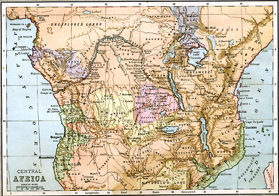
Description: A map of central Africa in 1883, prior to the Berlin Conference when European powers established their colonial territories on the continent. This map shows rivers, lakes, major cities, ports, and trade centers, as well as the names of native tribes and native lands in the region.
Place Names: A Regional Map of Africa, Lower Guinea, �Matebele's Land, �Mozambique, �Zanguebar, �Somali, �Unyamvez,
ISO Topic Categories: boundaries,
inlandWaters,
location,
oceans
Keywords: Pre-Colonial Central Africa, physical, �political, kBerlinConference, physical features, country borders, boundaries,
inlandWaters,
location,
oceans, Unknown, 1883
Source: , Handy Atlas of the World (New York, New York: Ivison, Blakeman, Taylor and Co., 1883) 29
Map Credit: Courtesy the private collection of Roy Winkelman |
|