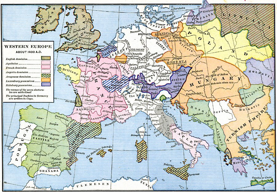
Description: A map of Western Europe about AD 1400, showing the domains at the time. This map is color–coded to show the territories of the English in the British Isles and Bordeaux region of France, the Aquitaine, French dominions, Angevin, Aragonese, Luxemburg, and Habsburg possessions. The names of the seven Electorates are underlined, and the principle Duchies in Germany are written in caps. This map also shows Brittany, Flanders, Prussia, portions of Lithuania and Poland, Moldavia, Wallachia, Hungary, Bosnia–Albania, Servia, the Malanese, Papal States, Naples, Castile, and the Ottoman Turk territories in Europe.
Place Names: Western and Central Europe, France, �Germany, �Hungary, �Ireland, �Italy, �Lithuania, �Moldavia, �Poland, �Portugal, �Prussia, �Spain, �United Kingdo
ISO Topic Categories: oceans,
location,
inlandWaters
Keywords: Western Europe, borders, �political, kEuropeanOttomanEmpire, country borders, oceans,
location,
inlandWaters, Unknown, 1400
Source: Robert H. Labberton, New Historical Atlas and General History (New York, NY: Townsend MacCoun, 1886) Plate XXXIX
Map Credit: Courtesy the private collection of Roy Winkelman |
|