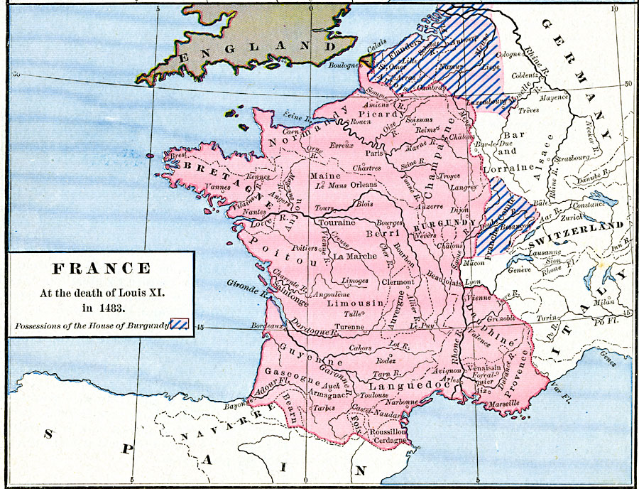
Description: A map of France at the time of the death of Louis XI in 1483. This map is color–coded to show French territory, the possessions of the House of Burgundy (Artois, Flanders, and Franche–Comte), and the English possessions of the Guernsey Islands and Calais.
Place Names: France, Bretagne, �Burgundy, �Champagne, �Dauphine, �Languedoc, �Normandy, �Poito
ISO Topic Categories: oceans,
location,
inlandWaters
Keywords: France at the death of Louis XI, borders, �political, country borders, oceans,
location,
inlandWaters, Unknown, 1483
Source: Robert H. Labberton, New Historical Atlas and General History (New York, NY: Townsend MacCoun, 1886) Plate XL
Map Credit: Courtesy the private collection of Roy Winkelman |
|