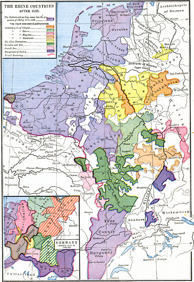
Description: A map of the Rhine Countries after 1543, when Charles V expanded the territories of the Holy Roman Empire into the Netherlands. This map shows the extended border of the Empire and France with a red line. The map is color-coded to show the Netherlands as acquired by Philip II in 1556 (the Seventeen Provinces, or Spanish Netherlands), the four Rhenish Electorates established by Charles, including the Archbishoprics of Cologne, Treves, Mayence, and Palatinate, the Cleve possessions, Lorraine and Bar (barony), French Bar (barony), and the Marquisate of Baden. This map also shows the northern portion of the Free Country of Burgundy, and the boundaries of archbishopric, bishoprics, and territories of the western (German) portion of the Empire. An inset map shows the ten regional Imperial Circles of Germany, Burgundian, Westphalian, Lower Saxon, Upper Saxon, Lower Rhenish, Upper Rhenish, Franconian, Suabian, Bavarian, and Austrian.
Place Names: Western and Central Europe, Burgundy, �France, �Holland, �Luxemburg, �Netherland
ISO Topic Categories: oceans,
location,
inlandWaters,
boundaries
Keywords: The Rhine Countries, borders, �political, country borders, oceans,
location,
inlandWaters,
boundaries, Unknown, 1543
Source: Robert H. Labberton, New Historical Atlas and General History (New York, NY: Townsend MacCoun, 1886) Plate XLII
Map Credit: Courtesy the private collection of Roy Winkelman |
|