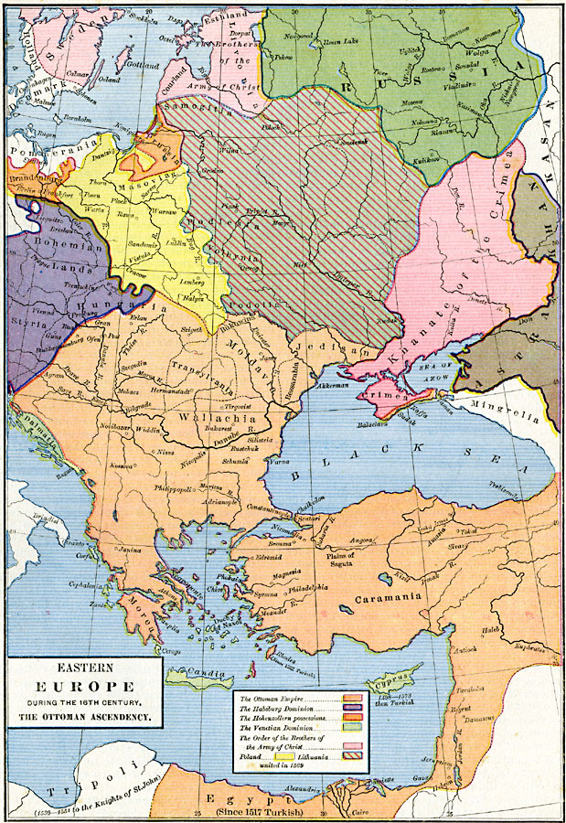
Description: A map of Eastern Europe and Asia Minor during the 16th Century, subtitled "The Ottoman Ascendancy." The map is color–coded to show the various territories the region, including the Ottoman Empire, the Habsburg Dominion, the Hohenzollern possessions, the Venetian Dominion, the Order of the Brothers of the Army of Christ (Teutonic Knights) Poland, and Lithuania (united in 1569). This map also shows Holland and Denmark in Sweden, portions of Russia, Pommerania (Pomerania), Astrakhan, Mingrelia, and Tripoli in Northern Africa to the Knights of St. John between 1530 and 1551. The Ottoman Empire (Osmanli) is shown to include Jedisan, Moldavia, Bukowina, Moldavia, Transylvania, Wallachia, the southern coast of Crimea, Morea (Greece), Caramania (Anatolia), Jerusalem, and Egypt (1517). Important cities of the time and major rivers are shown.
Place Names: Regional EurAsia, Bohemia, �Denmark, �Egypt, �Holland, �Hungary, �Prussia, �Russia, �Swede
ISO Topic Categories: borders, �political, kWorldMedSea, kWorldEurasia, kWorldAfroAsia
Keywords: Eastern Europe, borders, �political, country borders, borders, �political, kWorldMedSea, kWorldEurasia, kWorldAfroAsia, Unknown, 1500's
Source: Robert H. Labberton, New Historical Atlas and General History (New York, NY: Townsend MacCoun, 1886) Plate XLIV
Map Credit: Courtesy the private collection of Roy Winkelman |
|