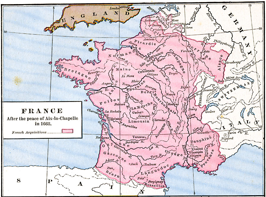
Description: Map of France after the Peace of Aix–la–Chapelle (Aachen) in 1668, ending the War of Devolution between France and the Habsburgs over control of the Spanish Netherlands. The map is color–coded to show French land acquisitions in Flanders, and also shows the territories returned by the French under terms of the treaty, including Franche–Comte and the city of Strasbourg.
Place Names: France, Alsace, �Bretagne, �Champagne, �Dauphine, �Dorraine, �Languedoc, �Normandy, �Poitou, �Provenc
ISO Topic Categories: oceans,
location,
inlandWaters
Keywords: France after the peace of Aix-la-Chapelle, borders, �political, country borders, oceans,
location,
inlandWaters, Unknown, 1668
Source: Robert H. Labberton, New Historical Atlas and General History (New York, NY: Townsend MacCoun, 1886) Plate XLVI
Map Credit: Courtesy the private collection of Roy Winkelman |
|