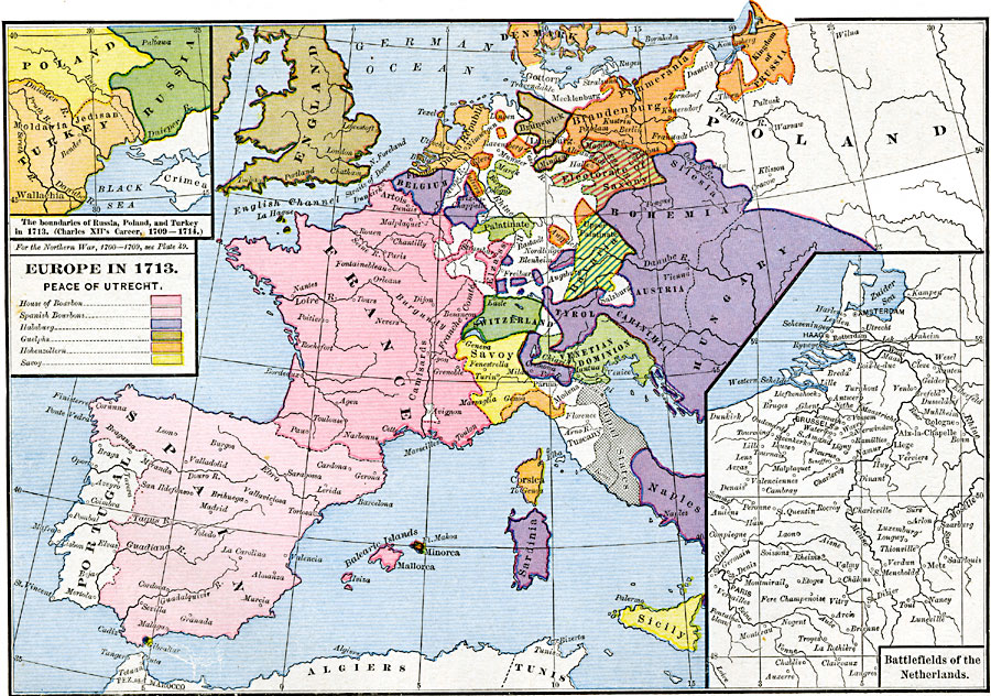
Description: A map of Europe after the Treaty of Utrecht at the end of the War of the Spanish Succession, showing country boundaries under control of the House of Bourbon, the Spanish Bourbons, Habsburg, Guelphs, Hohenzollern, and Savoy. Inset maps show the boundaries of Russia, Poland, and Turkey near the Black Sea and battlefields of the Netherlands.
Place Names: A Complete Map of Europe, Bavaria, �Belgium, �Bohemia, �Denmark, �England, �France, �Hungary, �Italy, �Poland, �Portugal, �Prussia, �Spain, �Switzerland, �United Kingdo
ISO Topic Categories: oceans,
location,
inlandWaters,
boundaries
Keywords: Europe, borders, �political, country borders, oceans,
location,
inlandWaters,
boundaries, Unknown, 1713
Source: Robert H. Labberton, New Historical Atlas and General History (New York, NY: Townsend MacCoun, 1886) Plate XLVII
Map Credit: Courtesy the private collection of Roy Winkelman |
|