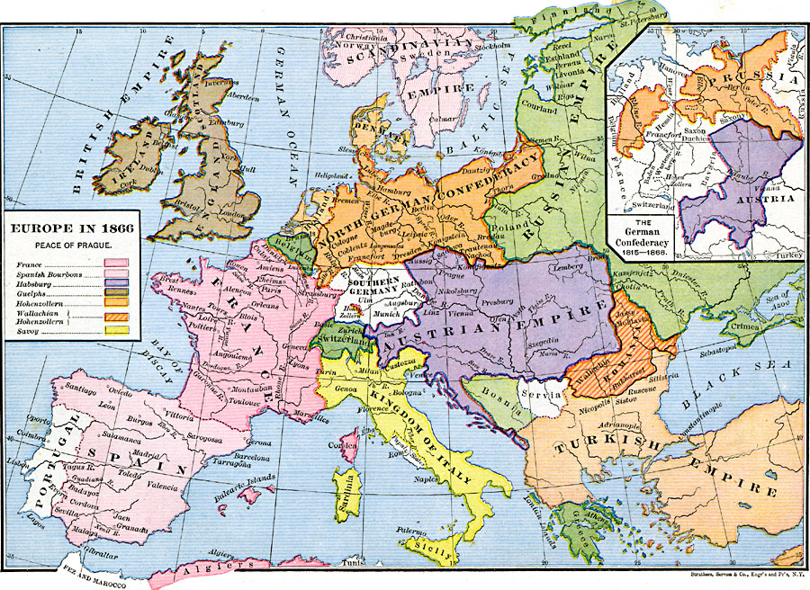
Description: A map of Europe in 1866, subtitled "Peace of Prague," referring to the treaty between Prussia under Bismarck and Austria under William I, which ended the Austro-Prussian War. The map is color-coded to show the countries and possessions in Europe at the time, including lands controlled by France, the Spanish Bourbons, Hapsburgs, Guelphs, Hohenzollern, Wallachian Hohenzollern, and Savoy, and the countries of the British Empire, portions of the Scandinavian Empire and Russian Empire, the North German Confederacy, Holland, Belgium, Luxemburg, Southern Germany, Austrian Empire, Romania, Servia, Bosnia, Switzerland, Portugal, Spain, Corsica, Sardinia, Kingdom of Italy, the Papal States, Greece, and the European portion of the Turkish Empire. Major rivers and important cities of the time are shown. The inset map shows the pre-war boundaries of Prussia and Austria between 1815 and 1866.
Place Names: Western and Central Europe, Austria, �Denmark, �Finland, �France, �Germany, �Greece, �Hungary, �Prussia, �Russia, �Sweden, �Switzerland, �Turke
ISO Topic Categories: oceans,
location,
inlandWaters,
boundaries
Keywords: Europe at the Peace of Prague , borders, �political, country borders, oceans,
location,
inlandWaters,
boundaries, Unknown, 1866
Source: Robert H. Labberton, New Historical Atlas and General History (New York, NY: Townsend MacCoun, 1886) Plate LII
Map Credit: Courtesy the private collection of Roy Winkelman |
|