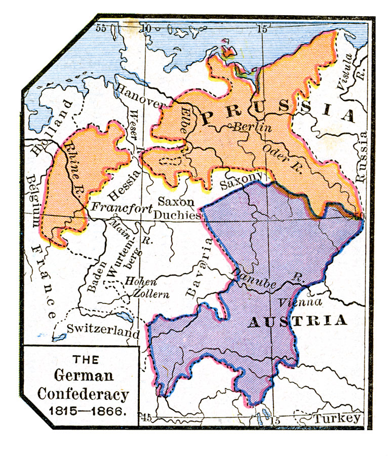
Description: A map of the Central European states that allied under the Conference of Vienna in 1815 to form the German Confederacy, which lasted until the Austro–Prussian War in 1866 and the collapse of the confederation. This map is color–coded to show the western Prussian and Austrian portions of the confederacy, as well as the German states of Hanover, Hessia, Saxony, Saxon Duchies, Baden–Wurttemberg, Hohenzollern, and Bavaria.
Place Names: Central Europe, Austria, �Prussi
ISO Topic Categories: oceans,
location,
inlandWaters,
boundaries
Keywords: The German Confederacy, borders, �political, kGermanConfederacy, country borders, oceans,
location,
inlandWaters,
boundaries, Unknown, 1815–1866
Source: Robert H. Labberton, New Historical Atlas and General History (New York, NY: Townsend MacCoun, 1886) Plate LII
Map Credit: Courtesy the private collection of Roy Winkelman |
|