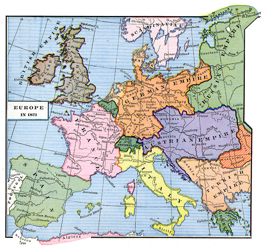
Description: A map of Europe in 1871 at the end of the Franco–Prussian War between the Second French Empire under Napoleon III and the allied forces of Prussia, the North German Confederation, and the South German states of Baden, Bavaria, and Würtemburg under Bismarck. The map is color–coded to show the territorial boundaries of the time, including France, the German Empire, the British Empire, portions of Scandinavia and the Russian Empire, Belgium, Holland, Switzerland, the Austrian Empire, Portugal, Spain, Italy, Greece, Wallachia–Moldavia, and portions of the Turkish Empire in Europe. Major rivers, territories, and important cities of the time are shown.
Place Names: Western and Central Europe, Austria, �Belgium, �Denmark, �England, �France, �Germany, �Greece, �Ireland, �Russia, �Scotland, �Sweden, �Switzerland, �Turke
ISO Topic Categories: oceans,
location,
inlandWaters,
boundaries
Keywords: Europe at the end of the Franco-Prussian War, borders, �political, country borders, oceans,
location,
inlandWaters,
boundaries, Unknown, 1871
Source: Robert H. Labberton, New Historical Atlas and General History (New York, NY: Townsend MacCoun, 1886) Plate LIII
Map Credit: Courtesy the private collection of Roy Winkelman |
|