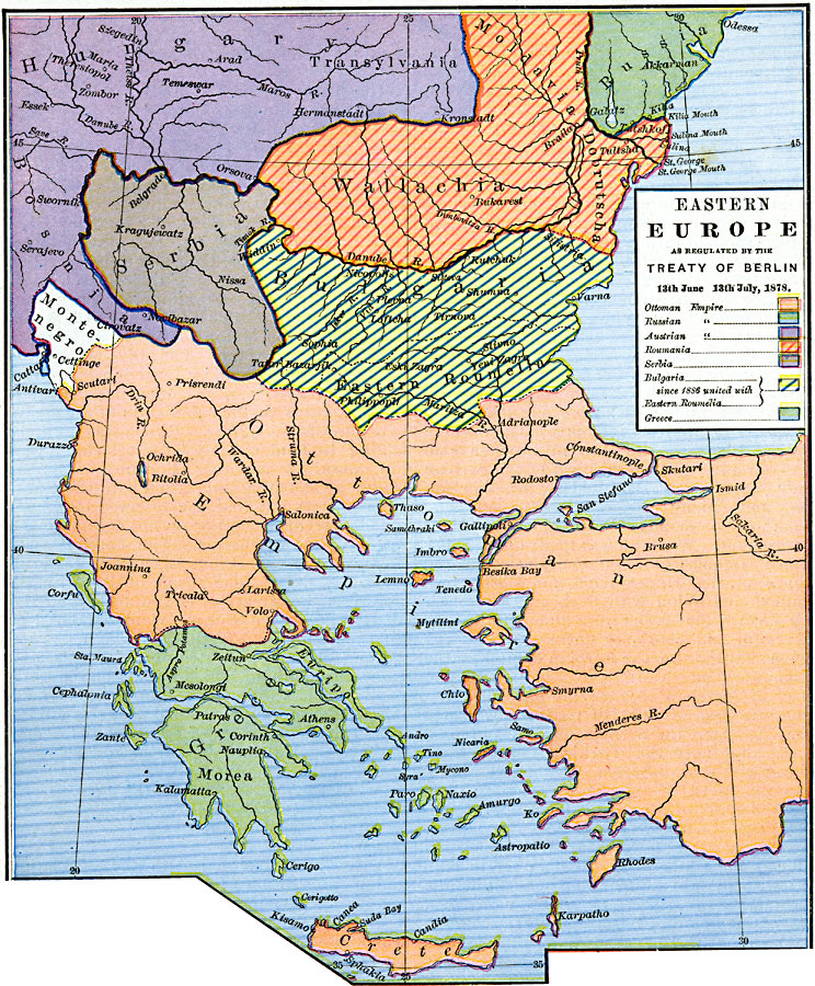
Description: A map of Eastern Europe as regulated by the Treaty of Berlin, 13th June–13th July, 1878, at the end of the Russo–Turkish War. This map is color–coded to show the effects of the treaty on the Ottoman Empire with regards to territory ceded to the Russian Empire, Austrian Empire, Romania, Bulgaria (united with Eastern Roumelia in 1886), Montenegro, and Greece. Major cities and rivers are shown.
Place Names: Southeastern Europe, Bulgaria, �Greece, �Hungary, �Ottoman Empire, �Russia, �Serbia, �Wallachia, Greece, Montenegro
ISO Topic Categories: oceans,
location,
inlandWaters,
boundaries
Keywords: Eastern Europe as regulated by the Treaty of Berlin, borders, �political, country borders, oceans,
location,
inlandWaters,
boundaries, Unknown, 13th June–13th July, 1878
Source: Robert H. Labberton, New Historical Atlas and General History (New York, NY: Townsend MacCoun, 1886) Plate LIV
Map Credit: Courtesy the private collection of Roy Winkelman |
|