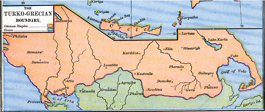
Description: A map showing the Turko–Grecian Boundary in 1878 at the end of the Russo–Turkish War, showing the boundaries between Greece and the Ottoman Empire established by the Treaty of San Stefano. An inset map shows the island of Crete under Turkish control.
Place Names: Southeastern Europe, Greece, �Turke
ISO Topic Categories: oceans,
location,
inlandWaters,
boundaries
Keywords: The Turko–Grecian Boundary, borders, �political, kEuropeanOttomanEmpire, country borders, oceans,
location,
inlandWaters,
boundaries, Unknown, 1878
Source: Robert H. Labberton, New Historical Atlas and General History (New York, NY: Townsend MacCoun, 1886) Plate LIV
Map Credit: Courtesy the private collection of Roy Winkelman |
|