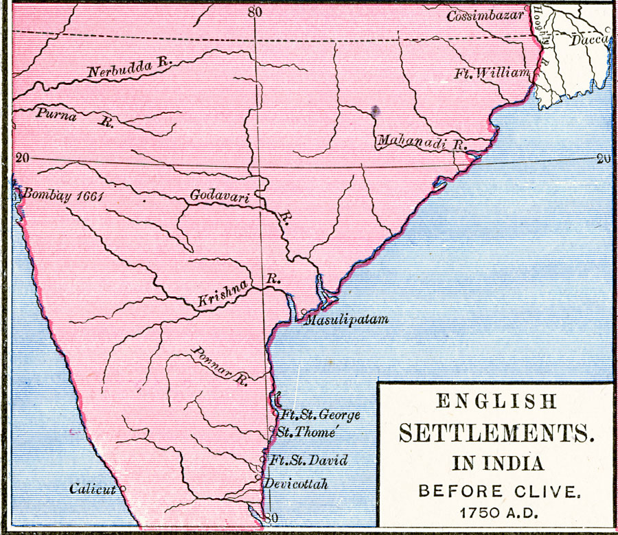
Description: A map of the English settlements in India prior to the arrival of Robert Clive (1744) and the beginnings of rule under the British East India Company after the Battle of Plassey (1757). The map shows the settlements of Cossimbazar and Fort William (Calcutta) in the north, Bombay (ceded to the British by Portugal in 1661) and Calicut (Kozhikode, actually under Dutch control at the time) on the Arabian Sea coast, and Masulipatam, Fort St. George, St Thomé (Mylapore, ceded to the British by Portugal in 1749), Fort St. David, and Devicottah on the southern Bengal Bay coast.
Place Names: India , Bombay, �Calicut, �Cossimbazar, �Krishna, �Masulipata
ISO Topic Categories: oceans,
location,
inlandWaters,
boundaries
Keywords: Anglo-India before Robert Clive, borders, �political, country borders, oceans,
location,
inlandWaters,
boundaries, Unknown, 1750
Source: Robert H. Labberton, New Historical Atlas and General History (New York, NY: Townsend MacCoun, 1886) Plate LVII
Map Credit: Courtesy the private collection of Roy Winkelman |
|