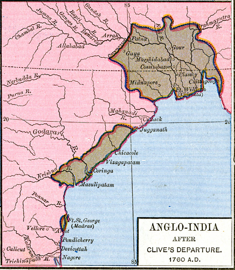
Description: A map of the eastern coast of India showing the Anglo-India (East India Company) possessions after Robert Clive's departure in 1760. The map is color–coded to show the extent of the British territories at the time, and shows the settlements of Fort William (Calcutta) and Fort George (Madras). "In 1599 an East India Company was founded in London. The trade, profitable as it was, remained small in extent, and the three early factories of the company (Madras, Bombay, and Calcutta) were only gradually acquired during the seventeenth century. These settlements had but little territory attached to them, and often trembled for their own safety. The genius and courage of Clive converted these traders into rulers of a large and magnificent empire. With his victory at Plassey (June 23, 1757) began the ascendency of England in the East. The victory at Wendewash (1760) established the British supremacy over Southern India." Lambert, 1891, p. 165.
Place Names: India , Chicacole, �Coringa, �Cossimbazor, �Gaya, �Gour, �Masulpatam, �Midnapore, �Patna, �Vilzagapata
ISO Topic Categories: oceans,
location,
inlandWaters,
boundaries
Keywords: Anglo-India after Clive's departure , borders, �political, country borders, oceans,
location,
inlandWaters,
boundaries, Unknown, 1760
Source: Robert H. Labberton, New Historical Atlas and General History (New York, NY: Townsend MacCoun, 1886) Plate LVII
Map Credit: Courtesy the private collection of Roy Winkelman |
|