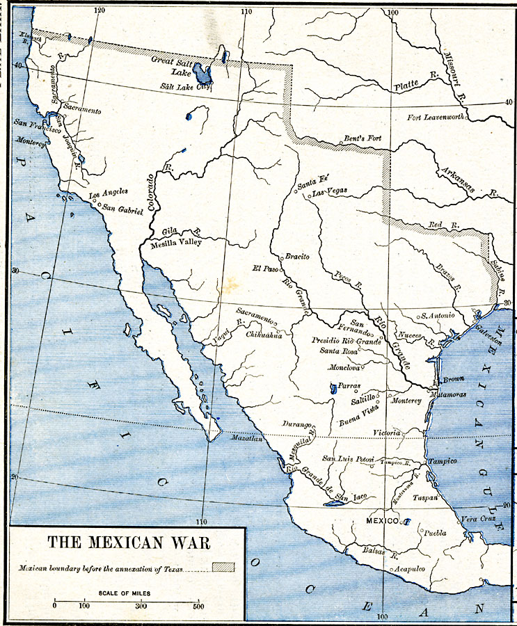
Description: A map of northern and central Mexico and southern United states showing the area of conflict during the Mexican–American War (1846–1848). The map shows the Mexican boundary (under Spain) established by the Louisiana Purchase (1803) before the annexation of Texas (1845), and also the major rivers of the area, forts, and battle sites of the war.
Place Names: A Regional Map of North America, United States, �Mexic
ISO Topic Categories: oceans,
location,
inlandWaters,
boundaries
Keywords: The Mexican War, borders, �historical, �political, country borders, other military, oceans,
location,
inlandWaters,
boundaries, Unknown, 1803–1848
Source: Robert H. Labberton, New Historical Atlas and General History (New York, NY: Townsend MacCoun, 1886) Plate LXIX
Map Credit: Courtesy the private collection of Roy Winkelman |
|