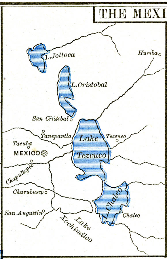
Description: A map of the area around Mexico City showing important sites of General Scott's campaign in the Mexican&ndash:American War (1846–1848). The map shows Lake Joltoca, Lake Cristobal, Lake Tezuco, Lake Xochimilco, and Lake Chalco, and the cities of Humba, San Cristobal, Tanepantla, Tacuba, Chapultepec, Churubusco, San Augustin, and Chalco.
Place Names: Mexico, Chalco, �Chapultepec, �Churubusco, �San Augustin, �San Cristobal, �Tanepantla, �Tezuco, �Mexico, �United State
ISO Topic Categories: oceans,
location,
inlandWaters
Keywords: Vicinity of the City of Mexico, borders, �historical, other military, oceans,
location,
inlandWaters, Unknown, 1846–1848
Source: Robert H. Labberton, New Historical Atlas and General History (New York, NY: Townsend MacCoun, 1886) Plate LXIX
Map Credit: Courtesy the private collection of Roy Winkelman |
|