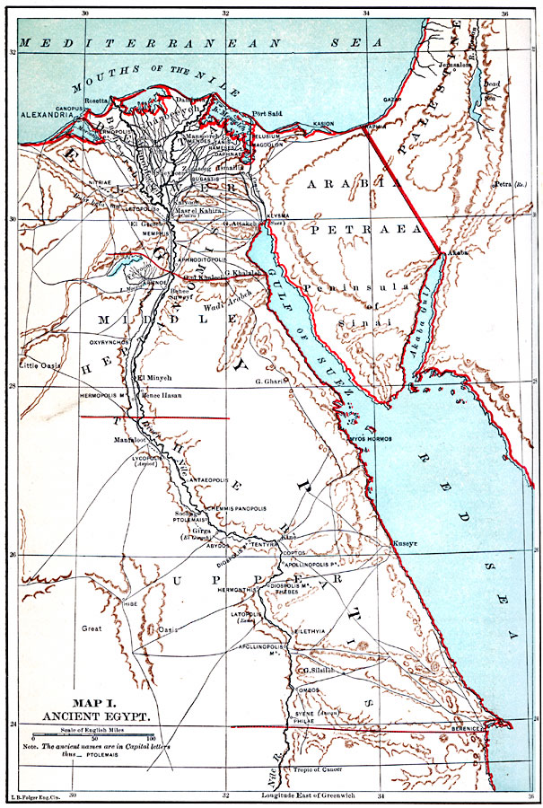
Description: A map from 1885 of Egypt showing contemporary and ancient cities of the region, including the borders along the Nile River between the Upper, Middle, and Lower kingdoms from 3150 to 31 BC. The ancient names of cities are given in capital letters. The map shows ports, railroads, caravan routes, and the Suez Canal.
Place Names: Egypt, Alexandria, �Al Minya, �Cairo, �Suez, �Thebes, �Memphi
ISO Topic Categories: boundaries,
oceans,
location,
inlandWaters
Keywords: Ancient Egypt, political, �transportation, country borders, roads, boundaries,
oceans,
location,
inlandWaters, Unknown, 3150 to 31 BCE
Source: John Clark Ridpath, Cyclopedia of Universal History (Cincinnati, OH: The Jones Brothers Publishing Co., 1885) 2
Map Credit: Courtesy the private collection of Roy Winkelman |
|