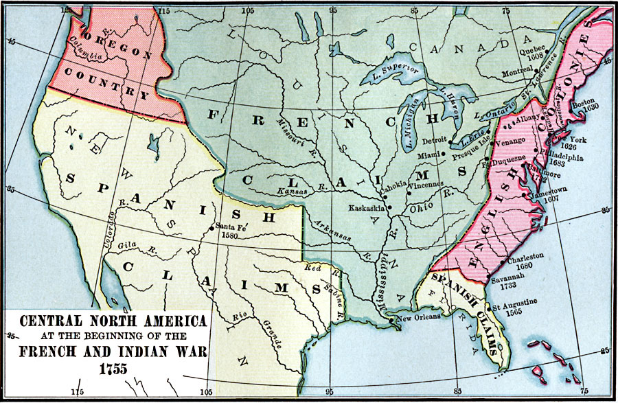
Description: A map of central North America showing territorial claims at the beginning of the French and Indian War in 1755. The map shows the Oregon Country, the Spanish claims to New Spain and Florida, the French claims to Louisiana and Canada, and the territory of the English Colonies. Major cities and settlements are shown with dates of settlement given for the larger settlements. This map also shows lakes and rivers.
Place Names: A Regional Map of North America, United States, �Mexico, �Canad
ISO Topic Categories: inlandWaters,
location,
oceans,
boundaries
Keywords: Central North America, physical, �political, �historical, �French and Indian War, �physical features, major political subdivisions, other military, inlandWaters,
location,
oceans,
boundaries, Unknown, 1755
Source: Charles Kendall Adams, A History of the United States (Boston, MA: Allyn and Bacon, 1909) 81
Map Credit: Courtesy the private collection of Roy Winkelman |
|