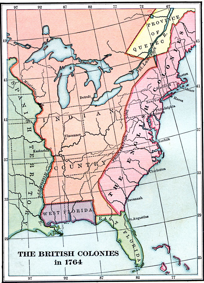
Description: A map of the eastern portion of North America showing the British, Spanish, and Indian territories after the French and Indian War (1754–1763), with the proclamation line as established by the Treaty of Paris (1763). "The newly acquired territory was divided into three provinces. Canada became the Province of Quebec, part of its southern boundary line limiting the present states of New York, Vermont, New Hampshire, and Maine. Florida was divided into two provinces, East and West Florida. A line was also drawn around the headwaters of all the Atlantic–flowing rivers in the colonies, and the colonists were forbidden to settle in the reserved territory, which was set apart for the Indians." — Adams, 1909, p. 86.
Place Names: A Regional Map of North America, Canada, �United State
ISO Topic Categories: boundaries,
inlandWaters,
location,
oceans
Keywords: British Colonies after the French and Indian War, physical, �political, �historical, physical features, major political subdivisions, boundaries,
inlandWaters,
location,
oceans, Unknown, 1764
Source: Charles Kendall Adams, A History of the United States (Boston, MA: Allyn and Bacon, 1909) 87
Map Credit: Courtesy the private collection of Roy Winkelman |
|