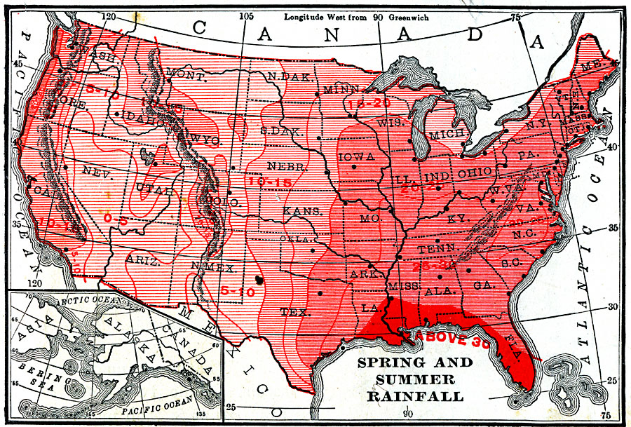
Description: A map from 1906 of the United States showing average spring and summer rainfall distribution, keyed to show areas of less than 10 inches in the season to more than 30 inches.
Place Names: Meteorology, rainfal
ISO Topic Categories: boundaries,
climatologyMeteorologyAtmosphere,
inlandWaters,
location,
oceans
Keywords: Spring and Summer Rainfall in the United States, physical, �meteorological, kClimate, physical features, rainfall, boundaries,
climatologyMeteorologyAtmosphere,
inlandWaters,
location,
oceans, Unknown, 1906
Source: Alexis Everett Frye, Frye's First Steps in Geography (Boston, MA: Ginn and Company, 1906) 55
Map Credit: Courtesy the private collection of Roy Winkelman |
|