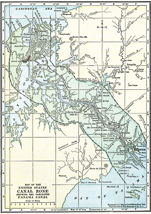
Description: A map from 1920 of the United States Canal Zone showing the completed Panama Canal. The map shows the entrance ports of Colon on the Caribbean Sea and the city of Panama on the Pacific, the Panama Railroad, the original portion of the canal by the French, lakes and water elevations, feeding rivers, location of the locks, the boundary line between the Canal Zone and the Republic of Panama, and the continental divide.
Place Names: Panama Canal Zone, Cristobal, �Colon, �Panam
ISO Topic Categories: oceans,
location,
inlandWaters
Keywords: United States Canal Zone showing the completed Panama Canal, borders, �political, country borders,
county borders, oceans,
location,
inlandWaters, Unknown, 1920
Source: , The New Reference Atlas of the World - A New Series of Physical, Political and Historical Maps compiled from Government Surveys and exhibiting the Latest Results of Geographical Research (New York, NY: C. S. Hammond & Company, 1920) 16
Map Credit: Courtesy the private collection of Roy Winkelman |
|