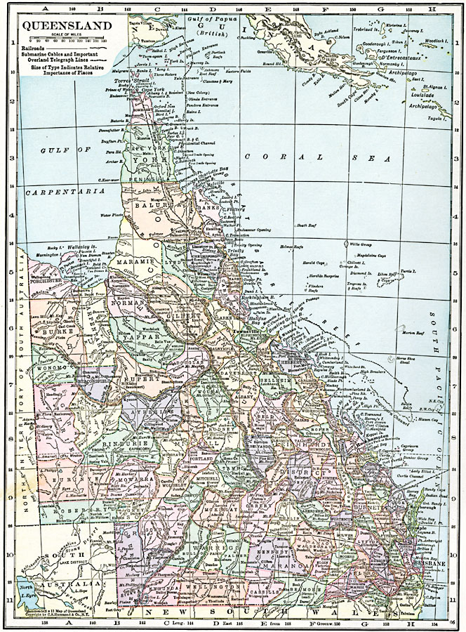
Description: A map of Queensland, Australia in 1920, showing counties, cities and ports, railways, submarine cable and important overland telegraph routes, rivers, lakes, mountains, and coastal features. The map shows the Great Barrier Reef and Torres Straight between Australia and New Guinea.
Place Names: Queensland, Brisbane, �Mackay, �Rockhampton, �Townsvill
ISO Topic Categories: oceans,
location,
inlandWaters
Keywords: Queensland, borders, �political, �transportation, county borders,
country borders, railroads, oceans,
location,
inlandWaters, Unknown, 1920
Source: , The New Reference Atlas of the World - A New Series of Physical, Political and Historical Maps compiled from Government Surveys and exhibiting the Latest Results of Geographical Research (New York, NY: C. S. Hammond & Company, 1920) 28
Map Credit: Courtesy the private collection of Roy Winkelman |
|