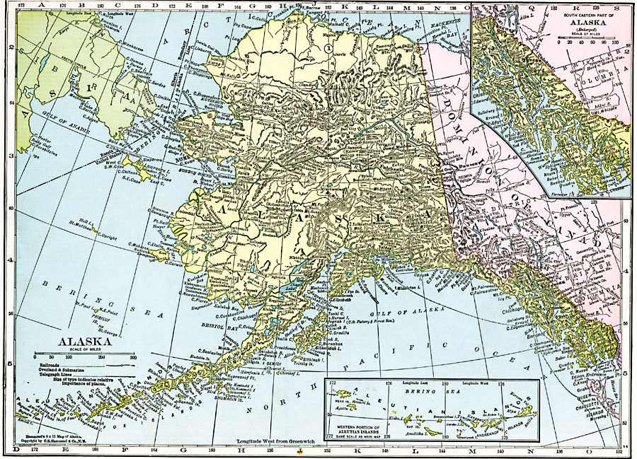
Description: A map of Alaska from 1920 showing the State capital at Juneau, cities, towns, ports, railroads, overland and submarine telegraph lines, major rivers and mountains, coastal features, and islands. The map has inset maps detailing the areas of the southeastern part of Alaska near Sitka, and the western part of the Aleutian Islands.
Place Names: Alaska, Anchorage, �Cordova, �Fairbanks, �Juneau, �Kenai, �Kodiak, �Nome, �Palmer, �Sitka, �Skagwa
ISO Topic Categories: oceans,
location,
inlandWaters
Keywords: Alaska, borders, �political, �transportation, country borders,
county borders, railroads,
water routes, oceans,
location,
inlandWaters, Unknown, 1920
Source: , The New Reference Atlas of the World - A New Series of Physical, Political and Historical Maps compiled from Government Surveys and exhibiting the Latest Results of Geographical Research (New York, NY: C. S. Hammond & Company, 1920) 31
Map Credit: Courtesy the private collection of Roy Winkelman |
|