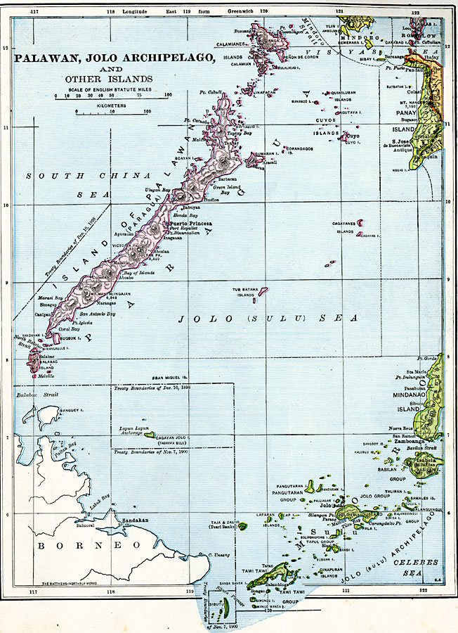
Description: A map from 1906 of the southwestern Philippine Islands of Palawan (Paragua) and the Jolo (Sulu) Archipelago. The map shows the boundaries of the Philippine territory established under the Treaty of Paris at the end of the Spanish–American War (December 10, 1898), and the inclusion of Cagayan Sulu and Sibutu under the Treaty of November 7, 1900. The map shows cities, mountains with elevations given in feet above sea level, islands and coastal features of the island groups.
Place Names: Philippines, Puerto Princesa, �Balabac Island, �Calamianes Islands,�Panay Island, �Mindanao Island, �Tawi Tawi, �Tub Bataha Islands, �Cagayanes Islands, �Cuyos Islands,
ISO Topic Categories: boundaries,
location
Keywords: Palawan, Jolo Archipelago, and other Western Philippine Islands, physical, physical features, boundaries,
location, Unknown, 1906
Source: Alexis Everett Frye, Frye's First Steps in Geography (Boston, MA: Ginn and Company, 1906) 121
Map Credit: Courtesy the private collection of Roy Winkelman |
|