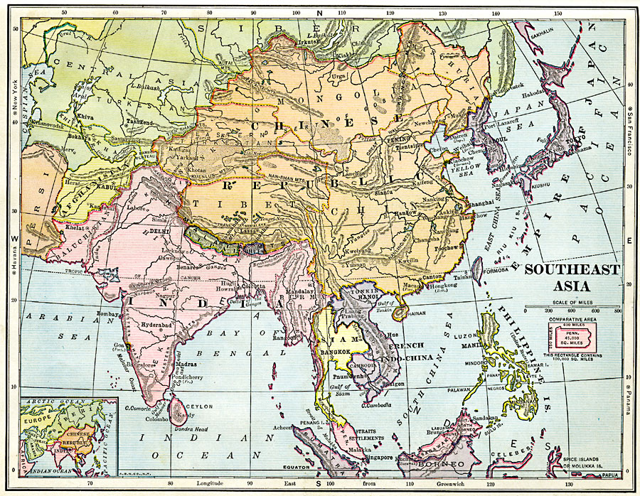
Description: A map from 1906 of Southeast Asia showing the political boundaries at the time, including the Chinese Republic, the Japanese Empire (including Korea and Formosa or Taiwan), the extent of British India (including Baluchistan and Burma) and French Indo–China (including Tonkin, Laos, Annam, and Cambodia). The map shows province boundaries, capitals and major cities, mountain systems, plateaus, deserts, rivers, coastal features, and islands of the region. A locator map shows all of Asia for reference, relative latitudes for other major cities of the world are shown in the side margins, and an outline map of Pennsylvania at the same map scale is included to show comparative area size.
Place Names: Miscellaneous Asia, China, �India, �Japan, �Mongolia, �Phillipines, �Turkestan, �Afghanistan, �Siam, �French Indo-China, �Empire of Japan, �Chinese Republic, �Korea, �Baluchistan, �Persia,
ISO Topic Categories: boundaries,
location,
inlandWaters,
oceans
Keywords: Southeast Asia, physical, �political, kComparativeArea, physical features, country borders, boundaries,
location,
inlandWaters,
oceans, Unknown, 1906
Source: Alexis Everett Frye, Frye's First Steps in Geography (Boston, MA: Ginn and Company, 1906) 123
Map Credit: Courtesy the private collection of Roy Winkelman |
|