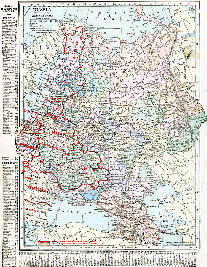
Description: A political map of Russia in Europe and Caucasia in 1920, revised to show the conjectural boundaries of the states of Finland, Esthonia, Livonia, Courland, Lithuania, Poland, Ukraine, Roumania, and Bulgaria, and the territory to the south of the Free City of Danzig (Gdansk), sovereignty to be decided by plebiscite. The map is color–coded to show the Russian provinces, and shows major cities, railways, submarine cable routes, and the city of Memel ceded by the Germans after WWI. The map has a grid–reference key for the provinces and major cities on the left side and bottom of the map.
Place Names: Eastern Europe, Bulgaria, �Caucasia, �Constantinople, �Finland, �Kief, �Lithuania, �Moscow, �Petrograd, �Poland, �Russia, �Ukraine, �Warsa
ISO Topic Categories: oceans,
location,
inlandWaters,
boundaries
Keywords: Russia in Europe and Caucasia, borders, �political, �transportation, major political subdivisions,
country borders, railroads,
water routes, oceans,
location,
inlandWaters,
boundaries, Unknown, 1920
Source: , The New Reference Atlas of the World - A New Series of Physical, Political and Historical Maps compiled from Government Surveys and exhibiting the Latest Results of Geographical Research (New York, NY: C. S. Hammond & Company, 1920) 48
Map Credit: Courtesy the private collection of Roy Winkelman |
|