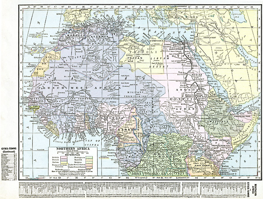
Description: A political map of the northern part of the African continent after WWI with reference to territories controlled by European countries and showing the former German territories ceded by the Treaty of Versailles to France and Britain. This map includes major cities, railroads and canals, rivers, and major landforms. This map also has a list of place names with location grid reference on the left and bottom edges.
Place Names: A Regional Map of Africa, Abyssinia, �Algeria, �Angola, �Egypt, �Entebbe, �Kamerun, �Liberia, �Morocco, �Nairobi, �Nigeria, �Sudan, �Tunis, �Ugand
ISO Topic Categories: oceans,
location,
inlandWaters,
boundaries
Keywords: Post WWI Northern Africa, borders, �political, �transportation, kVersailles, country borders,
county borders,
major political subdivisions, railroads,
water routes, oceans,
location,
inlandWaters,
boundaries, Unknown, 1920
Source: , The New Reference Atlas of the World - A New Series of Physical, Political and Historical Maps compiled from Government Surveys and exhibiting the Latest Results of Geographical Research (New York, NY: C. S. Hammond & Company, 1920) 51
Map Credit: Courtesy the private collection of Roy Winkelman |
|