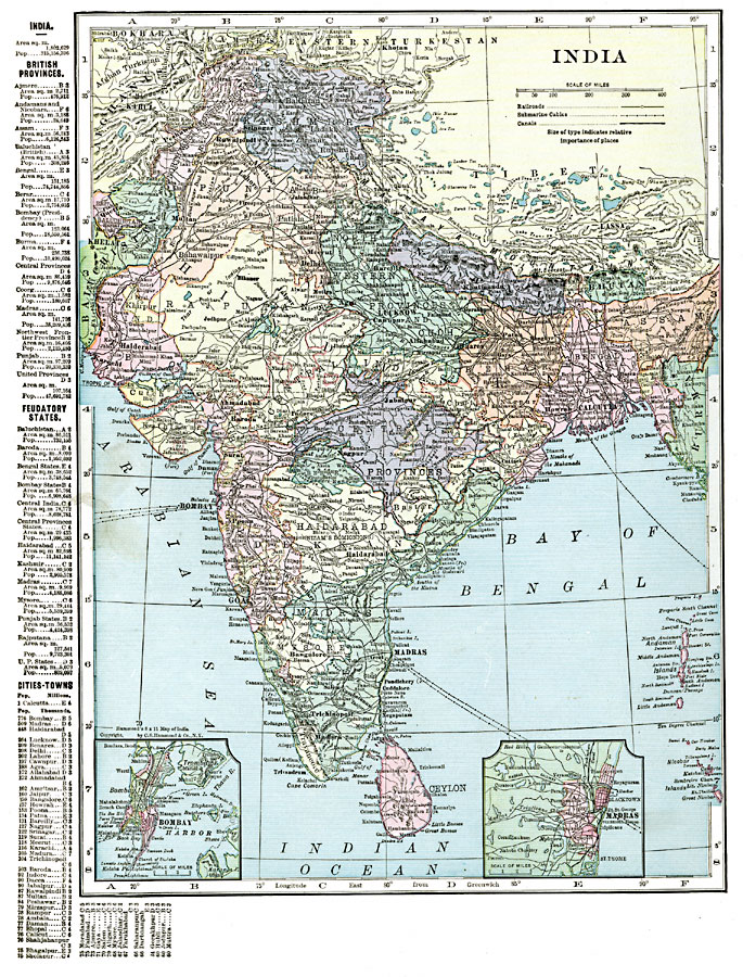
Description: A map from 1920 of India, showing the political divisions and country boundaries at the time. India was officially British Raj, made up of British controlled provinces and dependent Native States or Princely states (Hyderabad, Mysore, Kashmir, and Baroda being the largest), and this map is color–coded to show the provinces and Native States. The map shows capitals and major cities, railroads, canals, submarine cables, terrain, rivers, and coastal features. The neighboring countries of Nepal, Bhutan, and Ceylon (Sri Lanka), and frontiers of Baluchistan, Afghanistan, Eastern Turkestan, Tibet, and Burma (Myanmar) are shown. Two inset maps detail Bombay (Mumbai) and Madras.
A grid–reference key along the margin of this map helps locate the British provinces, feudatory states, and major cities and towns.
Place Names: India , Ahmadabad, �Bangalore, �Bhutan, �Calcutta, �Ceylon, �Cochin, �Goa, �Kandia, �Kanpur, �Kolkata, �Madras, �Mumbai, �Nagpur, �Nepal, �New Delhi, �Panaji, �Rajputan
ISO Topic Categories: oceans,
location,
inlandWaters,
boundaries
Keywords: India, borders, �political, �transportation, �physical, topographical,
physical features, country borders,
major political subdivisions, railroads,
water routes, oceans,
location,
inlandWaters,
boundaries, Unknown, 1920
Source: , The New Reference Atlas of the World - A New Series of Physical, Political and Historical Maps compiled from Government Surveys and exhibiting the Latest Results of Geographical Research (New York, NY: C. S. Hammond & Company, 1920) 58
Map Credit: Courtesy the private collection of Roy Winkelman |
|