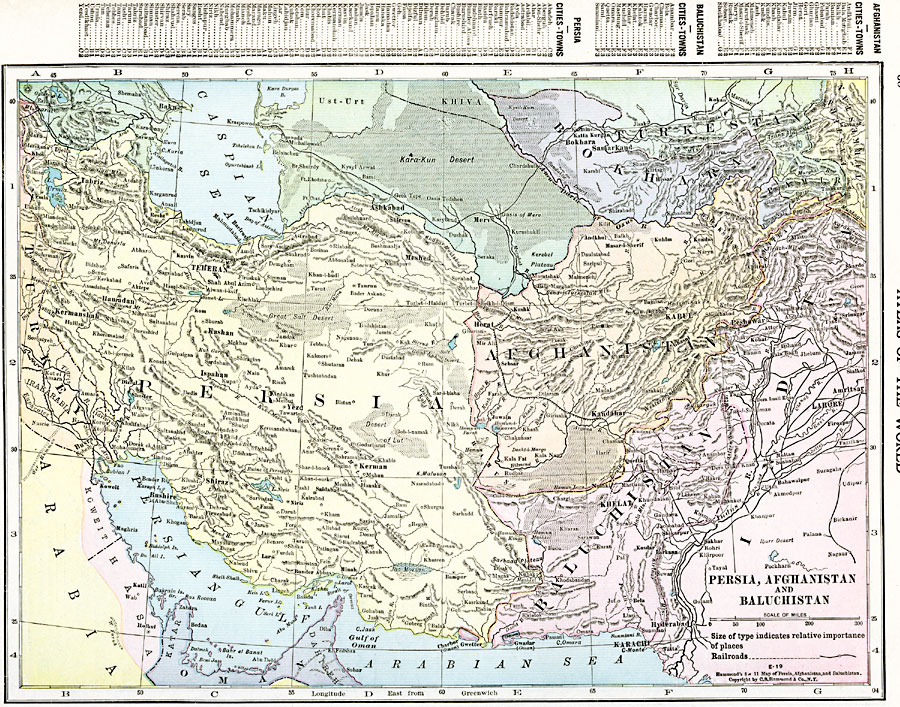
Description: A map from 1920 of Persia, Afghanistan, and Baluchistan showing the political boundaries at the time. The map shows capitals and major cities, ports, railways, mountain systems, plateaus, deserts, rivers, and coastal features of the region. A grid key locator at the top of the map references cities and towns in the region.
Place Names: Western Asia, Afghanistan, �Baluchistan, �Bokara, �Hamadan, �Kabul, �Kandahar, �Teheran, �Turkesta
ISO Topic Categories: oceans,
location,
inlandWaters,
boundaries
Keywords: Persia, Afghanistan, and Baluchistan, borders, �political, �transportation, �physical, topographical,
physical features, country borders,
major political subdivisions, railroads,
water routes, oceans,
location,
inlandWaters,
boundaries, Unknown, 1920
Source: , The New Reference Atlas of the World - A New Series of Physical, Political and Historical Maps compiled from Government Surveys and exhibiting the Latest Results of Geographical Research (New York, NY: C. S. Hammond & Company, 1920) 60
Map Credit: Courtesy the private collection of Roy Winkelman |
|