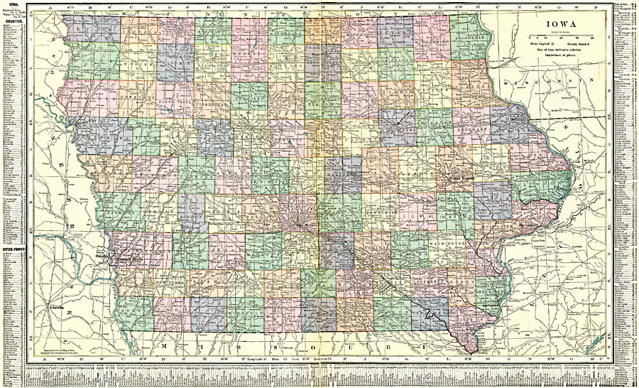
Description: A map from 1920 of Iowa showing the State capital of Des Moines, counties and county seats, major cities and towns, railroads, and rivers, including the border rivers of the Mississippi and Missouri. A grid reference in the margins of the map lists counties, principal cities, and towns of Iowa.
Place Names: Iowa, Burlington, �Cedar Falls, �Cedar Rapids, �Clinton, �Creston, �Des Moines, �Dubuque, �Hamburg, �Iowa City, �Mason, �Sioux City, �Waterlo
ISO Topic Categories: oceans,
location,
inlandWaters,
boundaries
Keywords: Iowa, borders, �political, �physical, country borders,
county borders, oceans,
location,
inlandWaters,
boundaries, Unknown, 1920
Source: , The New Reference Atlas of the World - A New Series of Physical, Political and Historical Maps compiled from Government Surveys and exhibiting the Latest Results of Geographical Research (New York, NY: C. S. Hammond & Company, 1920) 94-95
Map Credit: Courtesy the private collection of Roy Winkelman |
|