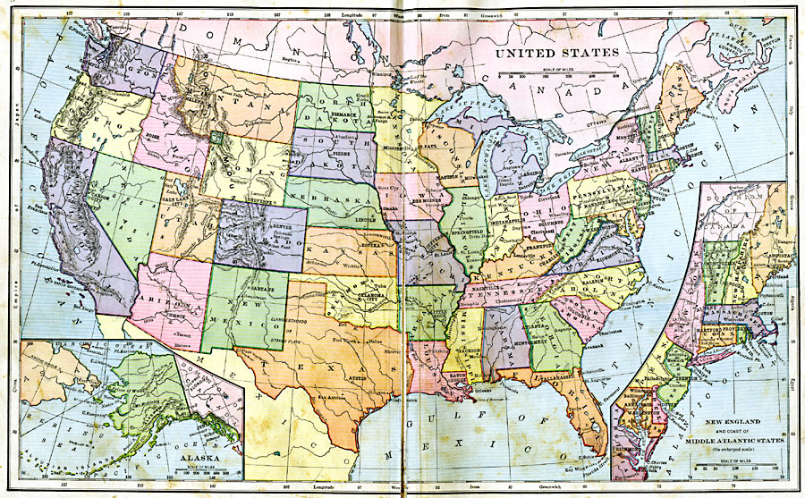
Description: A map from 1906 of the continental or ‘lower forty–eight’ United States showing state boundaries and state capitals, major cities and towns, mountain systems, lakes, rivers, and coastal features. Inset maps show the entire North American Region, a detail of Alaska, and New England with the coastal area of the Middle Atlantic States.
Place Names: A Complete Map of the United States, Boston, �Houston, �New Orleans, �New York, �Washington D.C., �Chicago, �Los Angeles, �San Diego, �Seattl
ISO Topic Categories: boundaries,
inlandWaters,
location,
oceans
Keywords: United States, physical, physical features, boundaries,
inlandWaters,
location,
oceans, Unknown, 1906
Source: Alexis Everett Frye, Frye's First Steps in Geography (Boston, MA: Ginn and Company, 1906) 144-145
Map Credit: Courtesy the private collection of Roy Winkelman |
|