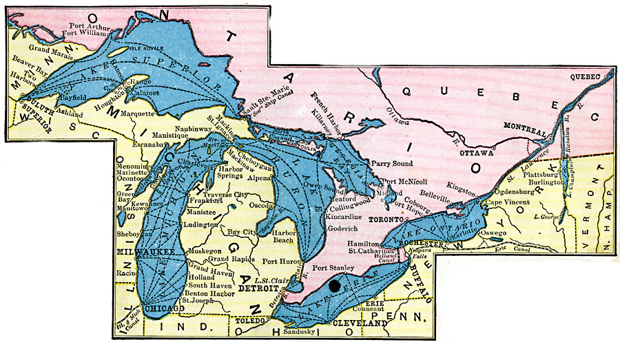
Description: A map from 1906 of the Great Lakes Region, showing major cities and ports, canals (including the Erie Canal), rivers, and steamship routes across the lakes, including routes of the St. Lawrence and Lake Champlain.
Place Names: A Regional Map of North America, Canada, �United States, �Lake Superior, �Lake Michigan, �Lake Huron, �Georgian Bay, �Lake Erie, �Lake Ontario,
ISO Topic Categories: transportation,
location,
inlandWaters,
boundaries
Keywords: Great Lakes Region, physical, �political, �transportation, physical features, country borders, water routes, transportation,
location,
inlandWaters,
boundaries, Unknown, 1906
Source: Alexis Everett Frye, Frye's First Steps in Geography (Boston, MA: Ginn and Company, 1906) 157
Map Credit: Courtesy the private collection of Roy Winkelman |
|