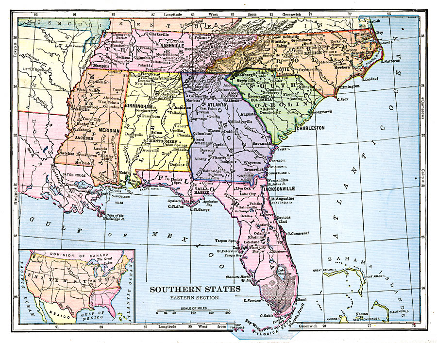
Description: The Southeastern States, showing physical features.
Place Names: Southern States, Nashville, �Tennessee, �Jackson, �Mississippi, �Montgomery, �Alabama, �Atlanta, �Georgia, �Raleigh, �North Carolina, �Columbia, �South Carolina, �Tallahassee, �Florida,
ISO Topic Categories: boundaries,
inlandWaters,
location,
oceans
Keywords: Southeastern States, physical, physical features, boundaries,
inlandWaters,
location,
oceans, Unknown, 1906
Source: Alexis Everett Frye, Frye's First Steps in Geography (Boston, MA: Ginn and Company, 1906) 162
Map Credit: Courtesy the private collection of Roy Winkelman |
|