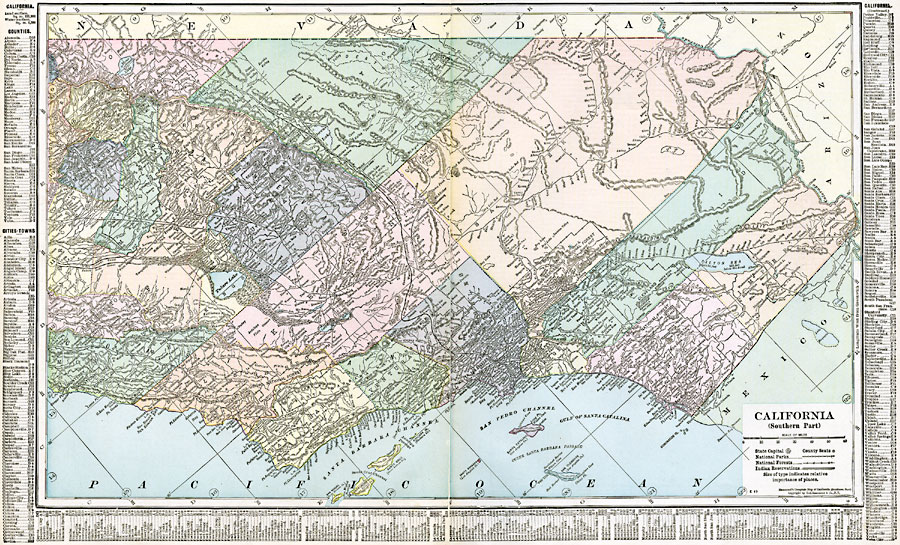
Description: A map of Southern California from 1920 showing the counties and county seats, major cities and towns, railroads, National Park boundaries, National Forest boundaries, Indian reservation boundaries, mountain systems, lakes, rivers, and coastal features. A grid reference in the margins of the map lists counties, principal cities, and towns of this part of the state.
Place Names: California, Bakersfield, �Eureka, �Los Angeles, �San Diego, �Santa Barbara, �Stockto
ISO Topic Categories: oceans,
location,
inlandWaters,
boundaries
Keywords: California (Southern), borders, �political, �physical, kNativeAmerican, county borders,
country borders, oceans,
location,
inlandWaters,
boundaries, Unknown, 1920
Source: , The New Reference Atlas of the World - A New Series of Physical, Political and Historical Maps compiled from Government Surveys and exhibiting the Latest Results of Geographical Research (New York, NY: C. S. Hammond & Company, 1920) 122-123
Map Credit: Courtesy the private collection of Roy Winkelman |
|