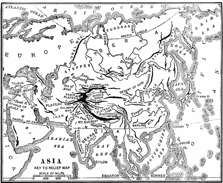
Description: An outline map from 1904 of Asia showing mountain systems, plateau, plains, major lakes, rivers, coastal features, and seas of the region. This map is used as a key map for locating landform features on a traditional relief map, where terrain is depicted pictorially and uncluttered by place name labels.
Place Names: A Complete Map of Asia, Plateau of Iran, �Desert of Gobi, �Arabia, �Plateau of Tibet, �Yangtze River,
ISO Topic Categories: inlandWaters,
location,
oceans
Keywords: Landforms of Asia, physical, physical features, inlandWaters,
location,
oceans, Unknown, 1904
Source: Alexis Everett Frye, Elements of Geography (Boston, MA: Ginn and Company, 1904) 87
Map Credit: Courtesy the private collection of Roy Winkelman |
|