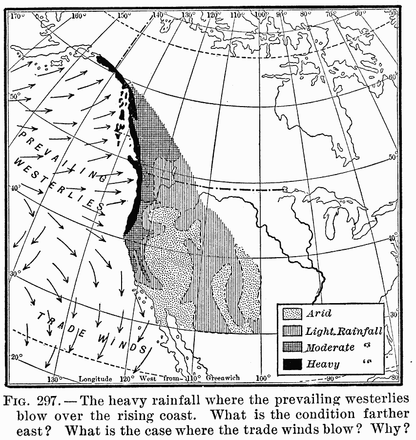
Description: A map of the western North America from 1910 showing the region along the Pacific coast northward from latitude 30° N., and in the southern portion to the 100th Meridian. The map shows heavy rainfall where prevailing westerlies blow over the rising coast, areas where rainfall ranges from light to heavy, and the arid areas of the region.
Place Names: A Regional Map of North America, North Americ
ISO Topic Categories: climatologyMeteorologyAtmosphere
Keywords: Western Rainfall Patterns, meteorological, kClimate, winds,
rainfall, climatologyMeteorologyAtmosphere, Unknown, 1910
Source: Ralph S. Tarr, B.S., F.G.S.A. and Frank M. McMurry, Ph.D., New Geographies (Second Book) (New York , NY: The MacMillan Company, 1910) 211
Map Credit: Courtesy the private collection of Roy Winkelman |
|