mapsMaps ETC Site map
 Maps ETC > Globes and Multi-continent > Regional Atlantic Ocean > The currents of the North Atlantic, 1910
Site Map 

The currents of the North Atlantic, 1910

The currents of the North Atlantic


Title: The currents of the North Atlantic
Projection: Unknown,
Source Bounding Coordinates:
W: -80 E: 0 N: 60 S: -20

Main Map Page
Zoomify Version
B/W PDF Version
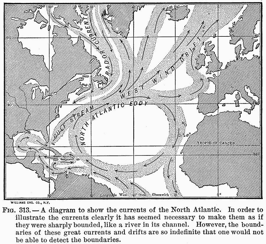
Description: A diagram to show the currents of the North Atlantic.
Place Names: Regional Atlantic Ocean, Africa, Europe, North America, South Americ
ISO Topic Categories: meteorological, kWorldAtlantic
Keywords: The currents of the North Atlantic, meteorological, winds, meteorological, kWorldAtlantic, Unknown, 1910
Source: Ralph S. Tarr, B.S., F.G.S.A. and Frank M. McMurry, Ph.D., New Geographies (Second Book) (New York , NY: The MacMillan Company, 1910) 221
Map Credit: Courtesy the private collection of Roy Winkelman
SearchLicensePDF HelpGIS Help Google Earth Help Zoomify Help

 Maps ETC > Globes and Multi-continent > Regional Atlantic Ocean > The currents of the North Atlantic, 1910
Site Map