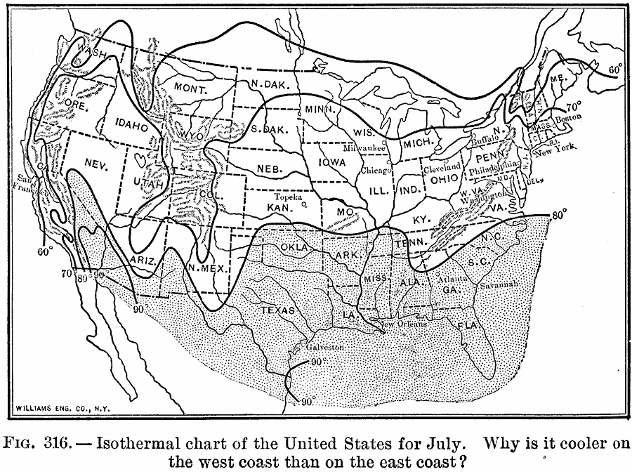
Description: A map from 1910 of the United States showing the mean temperatures in degrees Fahrenheit for the month of July. The map is coded to show the northern extent of the heat belt (above 80° F.).
Place Names: Meteorology, isothermal, �temperatur
ISO Topic Categories: oceans,
location,
inlandWaters
Keywords: Isothermal chart of the United States for July, meteorological, kClimate, winds,
temperature, oceans,
location,
inlandWaters, Unknown, 1910
Source: Ralph S. Tarr, B.S., F.G.S.A. and Frank M. McMurry, Ph.D., New Geographies (Second Book) (New York , NY: The MacMillan Company, 1910) 224
Map Credit: Courtesy the private collection of Roy Winkelman |
|