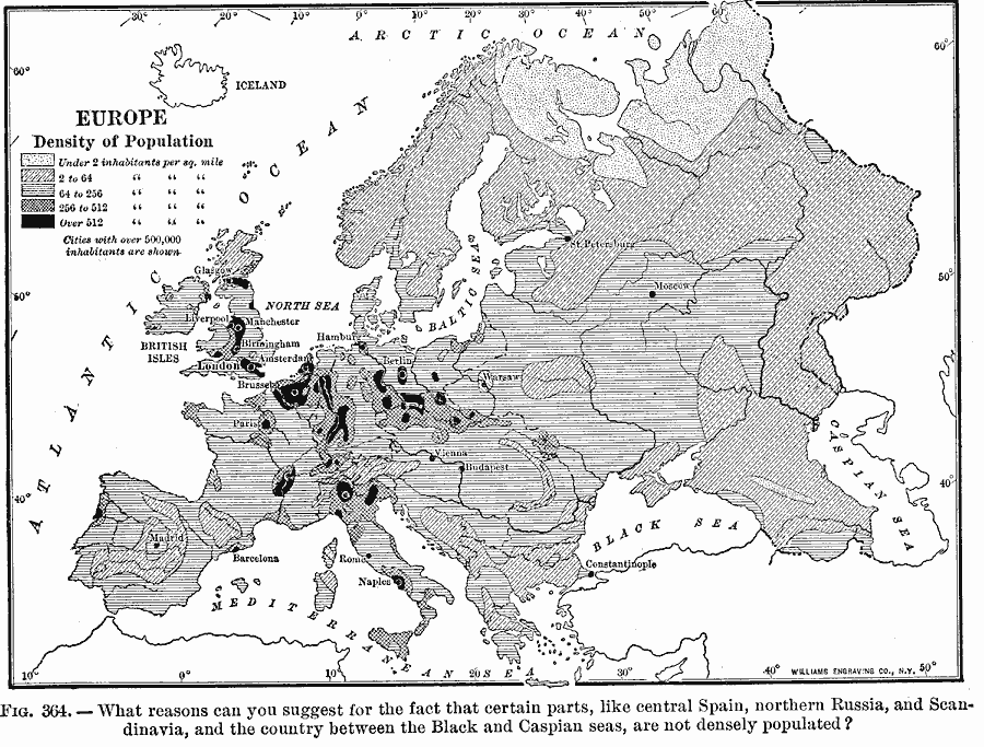
Description: A map from 1910 of population density in Europe, keyed to show area density ranges from under 2 to over 512 inhabitants per square mile, and cities with over 500,000 inhabitants.
Place Names: A Complete Map of Europe, France, �Germany, �Greece, �Italy, �Poland, �Portugal, �Romania, �Spain, �Sweden, �United Kingdo
ISO Topic Categories: oceans,
location,
inlandWaters
Keywords: Europe Density of Population, statistical, kPopulation, population, oceans,
location,
inlandWaters, Unknown, 1910
Source: Ralph S. Tarr, B.S., F.G.S.A. and Frank M. McMurry, Ph.D., New Geographies (Second Book) (New York , NY: The MacMillan Company, 1910) 261
Map Credit: Courtesy the private collection of Roy Winkelman |
|