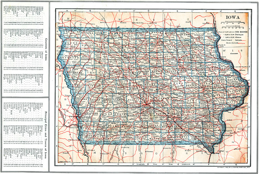
Description: A map from 1914 of Iowa showing the State capital of Des Moines, counties and county seats, major cities and towns, railroads and electric railroads, and rivers, including the border rivers of the Mississippi and Missouri. A grid reference in the margins of the map lists counties, principal cities, and towns of Iowa.
Place Names: Iowa, Sioux City, �Cedar Falls, �Des Moines, �Clinton, �Dubuque, �Waterloo, �Mason, �Iowa Cit
ISO Topic Categories: boundaries,
location,
inlandWaters,
transportation
Keywords: Iowa, physical, �political, �transportation, physical features, county borders, railroads, boundaries,
location,
inlandWaters,
transportation, Unknown, 1914
Source: , The New Encyclopedic Atlas and Gazetteer of the World (New York, NY: P. F. Collier and Son, 1914) 22
Map Credit: Courtesy the private collection of Roy Winkelman |
|