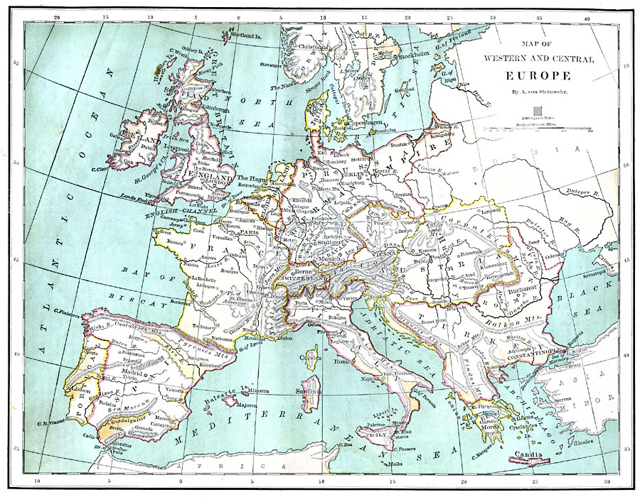
Description: A map of the Western and Central regions of Europe in 1870, showing cities, capitals, rivers, mountain systems, and political boundaries of the region at the time.
Place Names: Western and Central Europe, France, �Germany, �Greece, �Italy, �Portugal, �Romania, �Spain, �Sweden, �United Kingdo
ISO Topic Categories: boundaries,
inlandWaters,
location,
oceans
Keywords: Western and Central Europe, physical, �political, physical features,
topographical, country borders, boundaries,
inlandWaters,
location,
oceans, Unknown, 1870
Source: A. Von Steinwehr, Intermediate Geography (Cincinnati, OH: Wilson, Hinkle & Co., 1870) 68
Map Credit: Courtesy the private collection of Roy Winkelman |
|