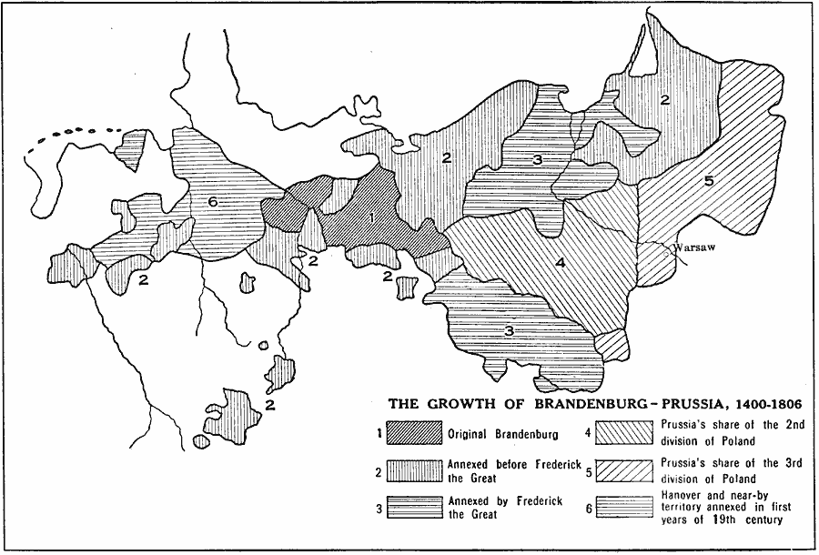
Description: A map of the growth of Brandenburg–Prussia from 1400, when the original Brandenburg was one of the seven electoral states of the Holy Roman Empire, to the annexation of Hanover and near–by territory in 1806. This map also shows the annexations prior to, and during the reign of Frederick the Great, and the annexations from the second and third divisions of Poland.
Place Names: Germany, Brandenburg, �Prussia, Warsaw
ISO Topic Categories: boundaries,
inlandWaters,
location
Keywords: Growth of Brandenburg-Prussia, physical, �political, �historical, �frederick the great, �poland, �hanover, annexed, physical features, country borders,
major political subdivisions, boundaries,
inlandWaters,
location, Unknown, 1400–1806
Source: L. P. Benezet, The Story of the Map of Europe (Chicago, Illinois: Scott, Foresman and Company, 1916) 99
Map Credit: Courtesy the private collection of Roy Winkelman |
|