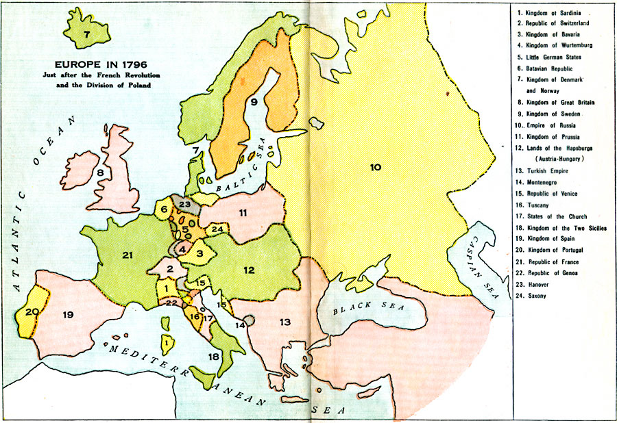
Description: A colored outline map of Europe in 1796 just after the French Revolution and the Division of Poland. Territories are numbered and referenced on the map.
Place Names: A Complete Map of Europe, Sardinia, �Switzerland, �Bavaria, �Wurtemburg, �Little German States, �Batavian Republic, �Denmark and Norway, �Great Britain, �Sweden, �Russia, �Prussia, �Austria-Hungary, �Turkish Empire, �Montenegro, �Republic of Venice, �Tuscany, �States of the Chu
ISO Topic Categories: boundaries,
oceans
Keywords: Europe, physical, �political, �historical, kFrenchRevolution, physical features, country borders, boundaries,
oceans, Unknown, 1796
Source: L. P. Benezet, The Story of the Map of Europe (Chicago, Illinois: Scott, Foresman and Company, 1916) 118-119
Map Credit: Courtesy the private collection of Roy Winkelman |
|